Malaria - map of Central America
Map of Central America with malaria risk areas
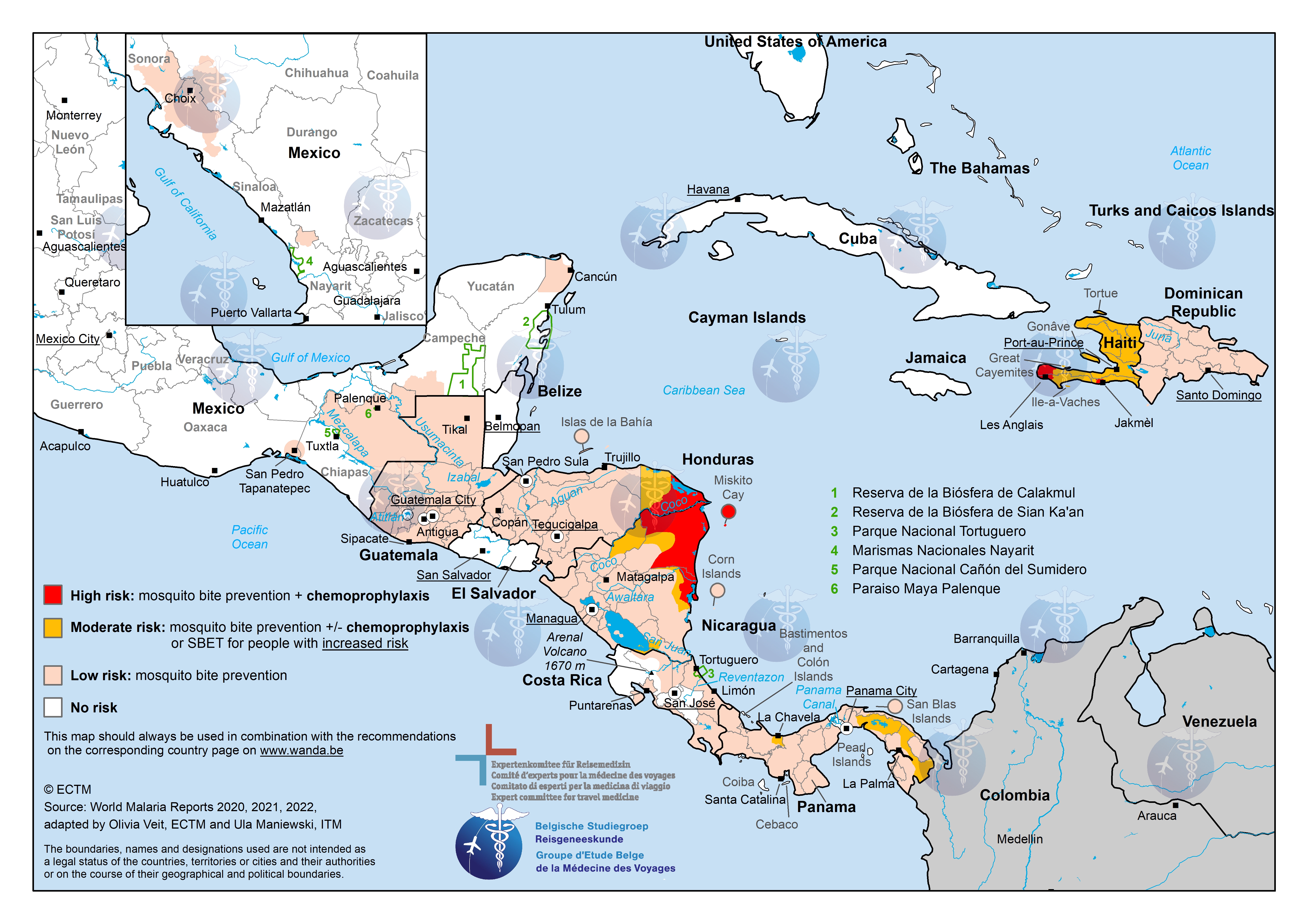
This image shows a map with the countries of Central America. Regions with a low risk of malaria are marked in light pink, regions with a moderate risk are marked in orange, regions with a high risk are marked in red and regions with a seasonal risk are marked in purple. This information, and the recommended preventive measures, can be looked up in detail on the separate pages for each country.
View a larger version of the map by clicking on it.
More information about malaria.